İstanbul

Şişli

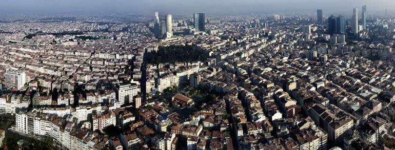
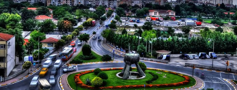
Şişli  is one of 39 districts of Istanbul, Turkey. Located on the European side of the city, it is bordered by Beşiktaş to the east, Sarıyer to the north, Eyüp and Kağıthane to the west, and Beyoğlu to the south. In 2009, Şişli had a population of 316,058. History Until the 1800s, Şişli was open…
Read more

Sultanbeyli

Sultanbeyli, Istanbul is a district of the province. Sultanbeyli name "place Sultanbeyli" were known later as the "Sultan Principality Farm", "Sultan Principality" later "sultanbeyli" as has been used. Linking Ankara and Istanbul Anadolu Highway (Highway 4) passes through the town and on the highway Sultanbeyli input box office can be made out. Istanbul's many districts…
Read more

Sultangazi

Sultangazi is one of Istanbul's newer inner-city districts. It was founded as a district proper in 2009 by the "New Local Government Law" in Istanbul, Turkey. To the west are the neighbourhoods of Esenler and Başakşehir, Gaziosmanpaşa is to the south and Eyüp is to the north and east. The district of Gaziosmanpaşa was divided…
Read more

Tuzla

Tuzla is a city in Bosnia and Herzegovina. It is the seat of the Tuzla Canton and is the economic, scientific, cultural, educational, health and tourist centre of northeast Bosnia. After Sarajevo and Banja Luka, Tuzla is the third largest city in Bosnia and Herzegovina. Preliminary results from the 2013 Census indicate that the municipality…
Read more

Ümraniye

Ümraniye  is a very large working class district of Istanbul, Turkey, with a population of over 650,000. It became district in 1987 by secession from Üsküdar. Also; Ömerli, Koçullu, Sırapınar and Hüseyinli villages were separated from Beykoz district in same year. Finally, Nişantepe quarter passed from Samandıra, where bounded to Kartal, to Alemdar, where bounded…
Read more

Üsküdar

Üsküdar (Turkish pronunciation: [ysˈcydaɾ]), formerly known as Scutari (Scutàrion, Σκουτάριον in Greek), is a large and densely populated district and municipality of Istanbul, Turkey, on the Anatolian shore of the Bosphorus. It is bordered on the north by Beykoz, on the east by Ümraniye, on the southeast by Ataşehir, on the south by Kadıköy, and…
Read more

Zeytinburnu

Zeytinburnu on the European side of Istanbul, is a town with an area of 12 km2. There are 13 neighborhoods. In Istanbul after the Turkish beginning in the hands of the first settlements, Jerusalem was made by the communities in the vicinity Kazlıçeşme the pastors name. at times they live in Jerusalem, the priest came…
Read more

Islands

Istanbul Islands has had many names throughout history. These; Evliya islands, Kesiş - Ruh islands, islands Cin - Halka (Ring) islands, Princes Islands, the Red islands. These are the most widely recognized by the world and the Prince Islands. The reason is from the Roman period, the rebels until after the Byzantine period, princes, and…
Read more

Büyükada (Big Island)

Istanbul is Büyükada, the largest of the islands. Surface area of 5.4 square kilometers. The distance is 2300 meters in the Maltepe coast. On the islands, including one of the two hills located south and north. The southern hill is YÜCETEPE the 203 meters in height. There the northern hill İsa Tepesi (Jesus Hill). World…
Read more

Heybeliada (Heybeli Island)

Heybeliada, Istanbul is the largest island after island of Büyükada. The reason it is called the island Heybeliada is the island resemble a saddle bag is allowed to place from afar. Istanbul is one of the most sought-after countryside. Just by nature, and not as clean air and beauty, the Navy, the Sanatorium, clergy (priest)…
Read more